
Survey and Excavations at Chiddingfold Villa 2002-2008
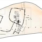
For some years now David and Audrey Graham have been undertaking fieldwork on the site of the building complex at Whitebeech, Chiddingfold in order to gain a better understanding of this enigmatic site. What follows is the text of a recent report to English Heritage dealing with the outcome of a geophysical survey. The report contains a useful summary of what has been achieved to date.
Summary